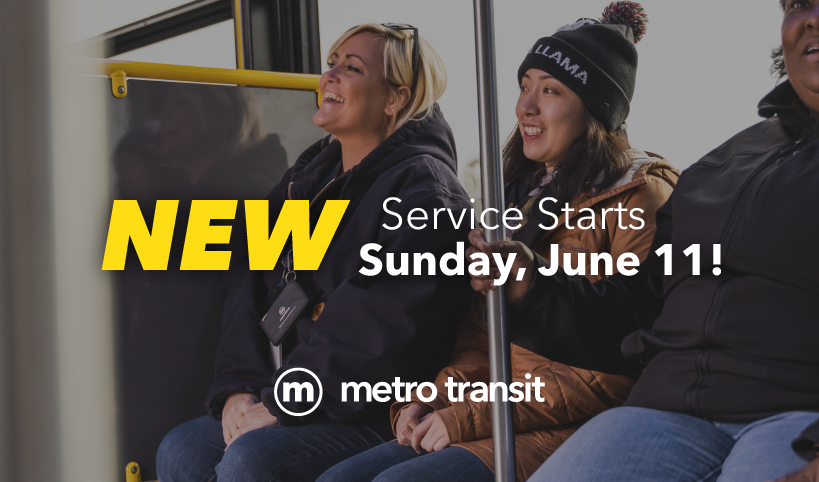
Transit Network Redesign

Complete Update to ALL Metro Routes Coming June 11!
Completely NEW Metro routes, maps and schedules go into effect on Sunday, June 11.
Plan your trip now on your mobile device using the Transit app!
(Make sure to set travel date as June 11 or later.)
Google trip planning data is still processing and is expected to be available soon.
Maps and schedules are still being designed. Call (608) 266-4466 or email mymetrobus@cityofmadison.com to receive early versions of materials by mail.
Map booklets are also available at all Madison library locations.
Print Information Flyers
English PDF // Spanish PDF // Hmong PDF // Arabic PDF // Chinese PDF // Russian PDF // Tibetan PDF // Nepali PDF
Print Promotion Poster
English PDF // Spanish PDF // Hmong PDF // Arabic PDF // Chinese PDF // Russian PDF // Tibetan PDF
Review Maps AND Schedules
| Google Map Text List Accessible Stops – By NumberText List Accessible Stops – Alphabetical | Online map. Determine connecting routes and which stops will be ADA accessible with start of service on June 11. |
| System Map PDF // Interactive Map | Complete overview of all routes. |
| Downtown PDF // Image | More detailed map of downtown area. |
| Service Chart // Print Maps/Schedules PDF | Collection of all maps/schedules starting Sunday, June 11. |
| Maps/Schedules Route A // Print PDF // Map Text Description | Frequent service every 15 minutes between Junction and Watts and East Towne via Mineral Point Road, Sheboygan Avenue, University Avenue, University and Johnson, State Street, Capitol Square, East Washington, Madison College, and East Washington Avenue.A1: Alternating trips continue east towards Sun Prairie Park and Ride via High Crossing, Highway 151, and Reiner.A2: Alternating trips continue east towards Hanson Road and Manufacturers Drive via Highway 151, American Parkway, Eastpark, and Hanson. |
| Maps/Schedules Route B // Print PDF // Map Text Description | Frequent service every 15 minutes between Fish Hatchery and Caddis Bend, Badger and Park, University and Johnson, State Street, Capitol Square, East Washington, North Street, Commercial, Packers, Northport, Troy, and Green. |
| Maps/Schedules Route C // Print PDF // Map Text Description | Frequent service every 15 minutes between the University Hospital and Cottage Grove and Dempsey via University Bay Drive, Old University, University and Johnson, Broom and Bassett, Jenifer, Winnebago, Atwood, and Cottage Grove.C1: Service continues to Cottage Grove and Sprecher via Cottage Grove.C2: Service continues to Cottage Grove and Sprecher via Buckeye). |
| Maps/Schedules Route D // Print PDF // Map Text Description | D1: Service every 30 minutes between Junction and Watts, and Sprecher and Cottage Grove via Watts, Gammon, Schroeder, Whitney, Tokay, Midvale, Odana, Monroe, Randall, University and Johnson, Gorham and Johnson, Milwaukee, and Wyalusing.D2: Service every 30 minutes between McKee and Maple Grove and the Dane County Airport via Maple Grove, Nesbitt, Fitchrona, Anton, Williamsburg, Verona Frontage, Chalet Gardens, Lovell, Allied, Verona Road, Nakoma, Monroe, Randall, University and Johnson, Gorham and Johnson, Fordem, Sherman, Tennyson, Packers, Darwin, and International.Combined frequent service on Routes D1 and D2 between Monroe and Nakoma, and Fordem and Johnson will result in service every 15 minutes. |
| Maps/Schedules Route E // Print PDF // Map Text Description | Service every 30 minutes between the Capitol Square and McKee at Maple Grove via West Washington, Regent, Highland, Franklin, Bluff, Blackhawk, Segoe, Mineral Point, Whitney, Raymond, Muir Field, and McKee. |
| Maps/Schedules Route F // Print PDF // Map Text Description | Service every 30 minutes between the Capitol Square, Middleton, and Junction and Watts via State, University and Johnson, Campus Drive, University, Segoe, Sheboygan, Whitney, University, Allen, Century, Parmenter, University, Eagle, Murphy, Deming, John Q Hammons, Greenway, Deming, Fourier, Excelsior, and Junction. Evening and weekend service is only between Sheboygan and Junction and Watts, with a coordinated transfer on Sheboygan to Route A for continuing service to downtown. |
| Maps/Schedules Route G // Print PDF // Map Text Description | Service every 30 minutes between Park and Badger, and East Washington and Independence via Badger, Rimrock, Badger, Pheasant Ridge, Deer Valley, Ski, Novation, Moorland, South Towne, Broadway, Monona Drive, Pflaum, Turner, Buckeye, Davies, Dempsey, Milwaukee, Stoughton, Commercial, Nakoosa, Walsh, Commercial, Thompson, Lien, Eagan, and East Washington. Service through most of Monona on Broadway and Monona Drive will remain non-stop. Coordinated continuing service to the west is available on Route H, and to the north on Route P. |
| Maps/Schedules Route H // Print PDF // Map Text Description | Service every 30 minutes between West Towne Mall and Park and Badger via Gammon, McKenna, Raymond, Reetz, Beltline Frontage, Verona Frontage, Beltline Frontage, Todd, Post, Coho, Greenway Cross, Fish Hatchery, and Badger. Coordinated continuing service to the east is available on Route G. |
| Maps/Schedules Route J // Print PDF // Map Text Description | Service every 30 minutes between Tree, Westfield, West Towne Mall, Gammon, Odana, Whitney, Tokay, Midvale, Mineral Point, Speedway, Highland, UW Hospital, University/ Johnson, and Brooks. |
| Maps/Schedules Route L // Print PDF // Map Text Description | Service every 80 minutes between Wheeler, Delaware, Tennyson, Aberg, Pick n Save, E. Washington, Wright, Madison College, Milwaukee, Walter, Atwood, Pflaum, Agriculture, Dutch Mill, Owl Creek.. |
| Maps/Schedules Route O // Print PDF // Map Text Description | Service every 60 minutes on a clockwise loop between University and Charter and Badger Road via Randall, Drake, Mills, Erin, Park, Olin, John Nolen, Rimrock, Rusk, Koster, Fisher, Badger, and Fish Hatchery. |
| Maps/Schedules Route P // Print PDF // Map Text Description | Service every 30 minutes on a clockwise loop starting at East Washington and Independence via Independence, Melody, Portage, Hayes, Anniversary, and Independence. |
| Maps/Schedules Route R // Print PDF // Map Text Description | R1: Service every 60 minutes between Junction and Watts and the Capitol Square via Mineral Point, High Point, Old Sauk, Old Middleton, Whitney, Sheboygan, Segoe, University, Campus Drive, University and Johnson, and State.R2: Service every 60 minutes between County Q and South Ridge in Middleton and the Capitol Square via Century, Branch, University, Park, Gammon, Old Sauk, Old Middleton, Whitney, Sheboygan, Segoe, University, Campus Drive, University and Johnson, and State. |
| Maps/Schedules Route S // Print PDF // Map Text Description | New service in Sun Prairie every 60 minutes on a counter-clockwise loop starting at the Sun Prairie Park and Ride via O’Keeffe, Main, Grove, Park, Market, Bristol, Tower, Bird, Windsor, Grand, and Reiner. |
| Maps/Schedules Route W // Print PDF // Map Text Description | New service in Sun Prairie every 30 minutes on weekdays only on a clockwise loop starting at the Sun Prairie Park and Ride via Reiner, Grand, Main, Highway 151, Windsor, Bird, Main, and O’Keeffe. |
| Maps/Schedules Route 28 // Print PDF // Map Text Description Note: Number of trips will double in August. | Service between UW Hospital and Sherman and Fordem via Observatory, Babcock, Linden, Charter, University and Johnson, Gorham and Johnson, Sherman, Mcguire, and Fordem. |
| Maps/Schedules Route 38 // Print PDF // Map Text Description Note: Number of trips will double in August. | Service from UW Hospital to Jenifer and Ingersoll via Observatory, Babcock, Linden, Charter, University and Johnson, Broom and Bassett, Wilson and Doty, Wilson, Williamson, and Jenifer Street. |
| Maps/Schedules Route 55 // Print PDF // Map Text Description | Service between Junction and Watts and Epic via Watts, High Point, Starr Grass, Waldorf, Mid Town, Woods, and Northern Lights. |
| Maps/Schedules Route 65 // Print PDF // Map Text Description | Service from UW Hospital to Fitchburg via Observatory, Babcock, Linden, Charter, University and Johnson, Broom and Bassett, John Nolen Drive, Rimrock, Highway MM, Brassica, Radicchio, Lacy, E Cheryl parkway, Fish Hatchery, Lacy, and Research Park Drive. |
| Maps/Schedules Route 75 // Print PDF // Map Text Description | Service between the Capitol Square and Epic via West Washington, Park, Fish Hatchery, McKee, Verona Road, Verona Avenue, Epic Lane, and Northern Lights. |
| Maps/Schedules Route 80 // Map Text Description | UW Campus Service. Frequent service from UW Hospital with some trips to Eagle Heights. |
| Maps/Schedules Route 81 // Map Text Description | UW Campus Service – Late Night. Frequent service throughout the east end of UW campus serving neighborhoods such as State-Langdon, Bassett, Dayton and Broom areas |
| Maps/Schedules Route 82 // Map Text Description | UW Campus Service – Late Night. Frequent service throughout UW campus. |
| Maps/Schedules Route 84 // Map Text Description | Frequent service throughout UW campus. |
Learn More About Upcoming Changes
If you’d like Metro staff to talk to your organization or group about new redesigned service, call (608) 266-4466 or email mymetrobus@cityofmadison.com.
Historical Plan Development Documents
Review details that lead to the development of Metro’s redesign plan.
More Information
Sign up for network redesign text and email alerts at mymetrobus.com/alerts.


